/ Jan 23, 2025
Trending

News Elementor

RECENT NEWS

Palisades and Eaton Fire Damage Maps

html

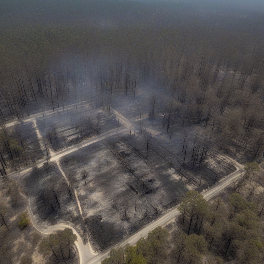
The recent fires in the Palisades and Eaton areas have left behind a scorched landscape, forever altering the beautiful natural surroundings and impacting local communities. Thanks to advanced aerial survey techniques, we now have comprehensive fire damage maps that provide a clear picture of the extent of destruction. This article gives an in-depth look at these maps, highlighting key affected areas and offering insights into the impact of these tragic events.

Overview of the Fire’s Impact

The fires that swept through Palisades and Eaton have not only destroyed countless acres but have also disrupted the lives of many residents. The fire maps serve as both a tool for understanding the scope of the damage and a guide for future recovery efforts. Aerial images show a patchwork of burnt and unburnt vegetation, illustrating the path and intensity of the flames.

Affected Areas

Significant areas have suffered severe damage, including:

  • Residential Areas: Several homes have been lost, leaving many families displaced. Efforts are underway to assist residents in rebuilding their lives.
  • Forested Regions: Extensive sections of forest have been charred, impacting local wildlife and ecosystems. Recovery in these areas will take time and careful intervention to ensure ecological balance is restored.
  • Coastlines: The coastal areas near these neighborhoods have been partially affected. While some beaches remain safe, others show signs of smoke and ash.

The Role of Aerial Surveys

Aerial surveys conducted by Air7 have provided invaluable data, capturing high-resolution images of the impacted zones. These aerial perspectives highlight:

  • Contrast in Landscapes: The mix of untouched greenery alongside blackened, barren land starkly contrasts the prior lush surroundings.
  • Visibility of Landmark Damage: Well-known landmarks in the area serve as reference points, demonstrating the fire’s reach and intensity.
  • Importance of Time-Stamps: By capturing the images during daylight, greater visibility into the extent of damage is achieved, assisting in precise planning for restoration.

Implications for the Future

While the immediate focus is often on recovery and relief, there’s a crucial conversation happening around future fire prevention. Here’s what the maps indicate about the road ahead:

Preparedness and Prevention

  • Infrastructure Updates: There’s a growing call to improve resilience in infrastructure against natural disasters.
  • Community Involvement: Educating locals about fire safety and mitigation practices is paramount in community efforts to prevent future incidents.
  • Ecological Recovery: In partnership with environmentalists, plans are in place to rehabilitate natural habitats.

Climate Change Considerations

Experts also point out that recent patterns indicate a correlation between climate change and the increased frequency of wildfires. It’s crucial to consider:

  • Changing Weather Patterns: The intensity of heat waves and droughts contributes significantly to fire risks.
  • Legislative Action: Authorities are urged to legislate policies that address these challenges more effectively.

Local Response and Recovery Efforts

The community response to these fires has been nothing short of remarkable. From local authorities to volunteer groups, efforts to assist those affected and begin ecological restoration have already begun.

Current Initiatives

  • Relief for Displaced Families: Temporary housing and resources are being provided to those who have lost their homes.
  • Reforestation Projects: Plans to replant and protect forested areas are being implemented by conservation groups.
  • Long-term Planning: Discussions are in place to ensure urban planning accounts for increased fire risks in the future.

As the Palisades and Eaton areas continue their journey toward recovery, fire damage maps offer crucial insights and guide the path forward. The visual data generated by aerial surveys not only documents the immediate aftermath but also helps build a more resilient future. Moving forward, communities are leveraging these insights to unite, rebuild, and develop strategies that prioritize safety and sustainability.

RECENT POSTS

CATEGORIES

Leave a Reply

Your email address will not be published. Required fields are marked *

HELP/SUPPORT

SUBSCRIBE TO US

Get the latest LA real estate news, market trends, and expert tips. Subscribe for weekly updates to stay informed and ahead in the LA property market.

Copyright LARealEstateBrief. 2024. DRE license #02134518